Days Five, Six, and Seven
/Author’s note: Apologies in advance for the length of this post. I write these for myself, as a diary of the ride, but in the name of all that’s holy, bail out when it gets boring. There’s no prize in finishing, no shame in skimming, and I won’t be giving a quiz. 🙃
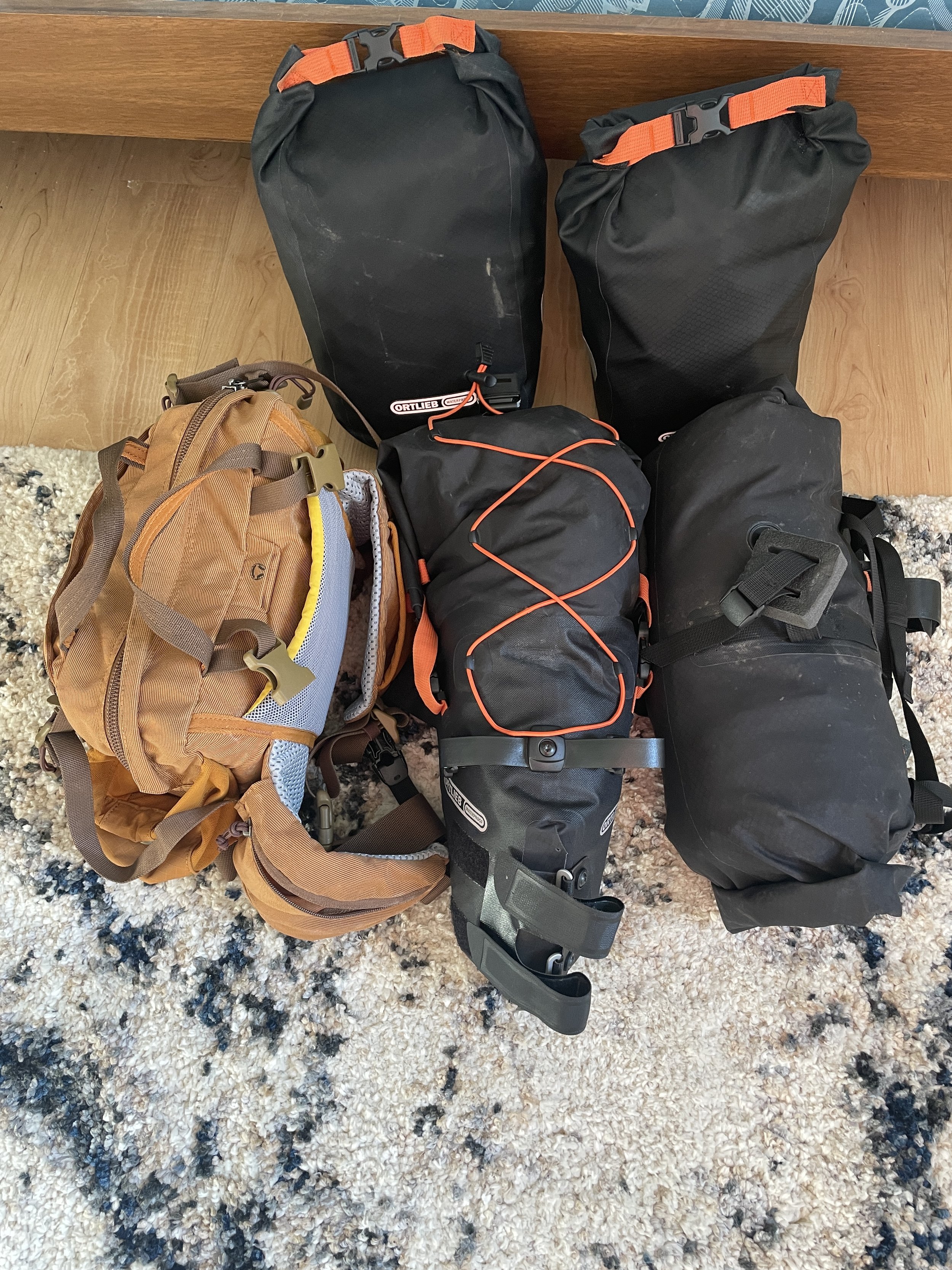
My initial plan for the end of Day Four called for it to end in Katahdin Stream Campground, in Baxter State Park. The first of two nights of camping in the park. In fact, on my ride into Millinocket from Medway, I’d stopped at the Hannaford’s to pick up food, ready for a little backcountry gourmet. But, with the onset of rain, and the uncertainty of the terrain, I’d decided to cut the day’s ride short in Millinocket, putting me behind a day in my schedule. Of course, what’s a schedule for a trip like this, except really just a point from which to begin an improvisation?
Waking up and getting ready in the Appalachian Trail Hostel & Outfitters, I heard trail stories coming from every room. Thru-hikers were comparing their best encounter, their best soaking wet campsite, their best emotional outburst at the completion of their hike on top of Mount Katahdin. Sleeping bags which had been hung up during the night to dry were being stuffed back into their sacks. The sound of unlaced boots shuffling across the floor and down the stairs filled the spaces between bits of muffled conversation. They conversations resumed as they waited for the van to take them to Bangor or other points South, bound once again for ‘real’ life.
Anyone who’s been to summer camp as a kid knows the scene: the smell of wet hardwood and dirt in humid summer air, the sound of slow-drizzling rain in early morning hours, the quiet of a group of young people waking up, laughing occasionally, shushing each other, galumphing about with neither sensitivity nor malice.
Once gone, I finished packing my bags and loaded them back onto my bike. I settled my tab and pulled out of town. The rain had relented (though the mizzle was moderate) and it looked like there might even be some sunshine on the horizon. I stopped for a selfie on the side of the road in front of a large boulder painted with a “Keep Maine Beautiful” mural while a couple of women climbed out of a Jeep about forty yards away.
“You want me to take your picture?” “Yes,” I said, “That’d be great! Thank you!”
She and her sister had been coming to Baxter State Park for years, since they were little. “We’re Maine-iacs,” she said proudly. “It’s a family tradition - she stops here and picks flowers before we get into the park, and I take pictures for tourists.”
Photo done, she asked where I was headed. “I’ve got sites reserved at Katahdin Stream and Trout Brook Farm. Thought I’d see how far I got today.”
“Trout Brook? That’s all the way on the other side of the park,” her sister offered. “Be a real long ride for you.”
“Well, like I said, I’ll see how far I get.”
I rode the 15 miles or so to the entrance of the park and rolled up to the gate. A sign told me to Please Stop and Turn Off Your Engine. I unclipped from my pedals. The ranger came out to greet me.
He explained the need for a misnamed “dash pass” I had to help him fill out and keep with me - a record for every park visitor, so they can keep track of everyone going in and everyone going out. For emergencies, etc. Though some of the questions weren’t really relevant, he asked them anyway, amused by their inappropriateness.
“License plate number?”
“How many in your party?”
“Are you carrying any firewood?”
Every question was followed with an amused chuckle, to himself as much as me.
Riding off, I hit the gravel road soon enough. This was one of the long-anticipated parts of my journey: the Park Tote Road of Baxter State Park. Crushed gravel and long, empty, wooded, winding roads for miles and miles. The road cuts through the forest like a hallway with that kind of wallpaper that every tacky country restaurant in the 70’s had on the way to the bathroom: that kind of treeaftertreeaftertreeaftertree with a symmetry and linearity that no forest ever actually has. But Baxter does. The road is walled on either side with thickets of trees one after the other so close together that not only could you not throw a stone further that 20 yards in any direction, you would likely need a headlamp to see your way through them, so think is the overhead canopy. And lined with a thick shag of moss all along the ground. “Thick as a bear’s fur,” I thought to my self. Storybook. Tolkien-esque. Elves and wood nymphs hid from my sight as I rode past.
Boom. Oh, right. The second of three reeelly big climbs I’d have on this tour. The first was up Cadillac Mountain. The last will be heading up and over the mountain between the Canadian Border and the St. Lawrence Seaway. And then this one - heading up about 1,500 feet over gravel the size of golf balls and divots in the road that you could hide a volleyball in. About 20 miles of that, all told. I did pretty well. But I reminded myself, as I unclipped halfway up one particularly step stretch, “There’s no shame in walking.” And on a 13% grade, with 25lbs. of gear, and with skree spinning under my tires meant really more for hardpack, the motto rang true enough to be sure.
But one thing I’ve noticed about riding the hills (and mountains) in Maine is that an uphill rarely plateaus and is instead usually followed by a commensurate downhill run. And I went flying down the other side of the mountain, with the kind of speed that I actually couldn’t laugh out loud about because I actually had to watch the road very carefully, knowing that the gravel that spun under my tires on the way up was lying in wait to thwart a smooth descent on the way down. Standing up in your pedals a few inches above your saddle, letting the bike bob and weave on its own while your legs take the shocks, is the smoothest way down a hill like that.
Quickly I came to Katahdin Stream Campground. And who do I see but the same women I met at the painted boulder, just getting out of their Jeep. They seemed more surprised to see me than I was to see them. “How’d you get here so fast?” One exclaimed. “And look at you, you’re not even winded!” It was true, actually, but only because I’d spent the last three to five miles on a beautiful, un-pedalled descent.
Muddy, clotted schools of hikers milled around the ranger station, apparently just back from a summit or planning their ascent. It was the same hiker culture I’d just left, and more power to them, but … I was looking for a less populated evening. I broke for lunch at a picnic table and got right back out on the road.
I had 25 miles under my belt. Another 35 lay ahead of me. And as I rode, the mist got thicker and even rained at some points. But I was determined - by getting to Trout Brook Farm that night, I could stay on my schedule AND get a more secluded campsite. Road grit and puddles be damned.
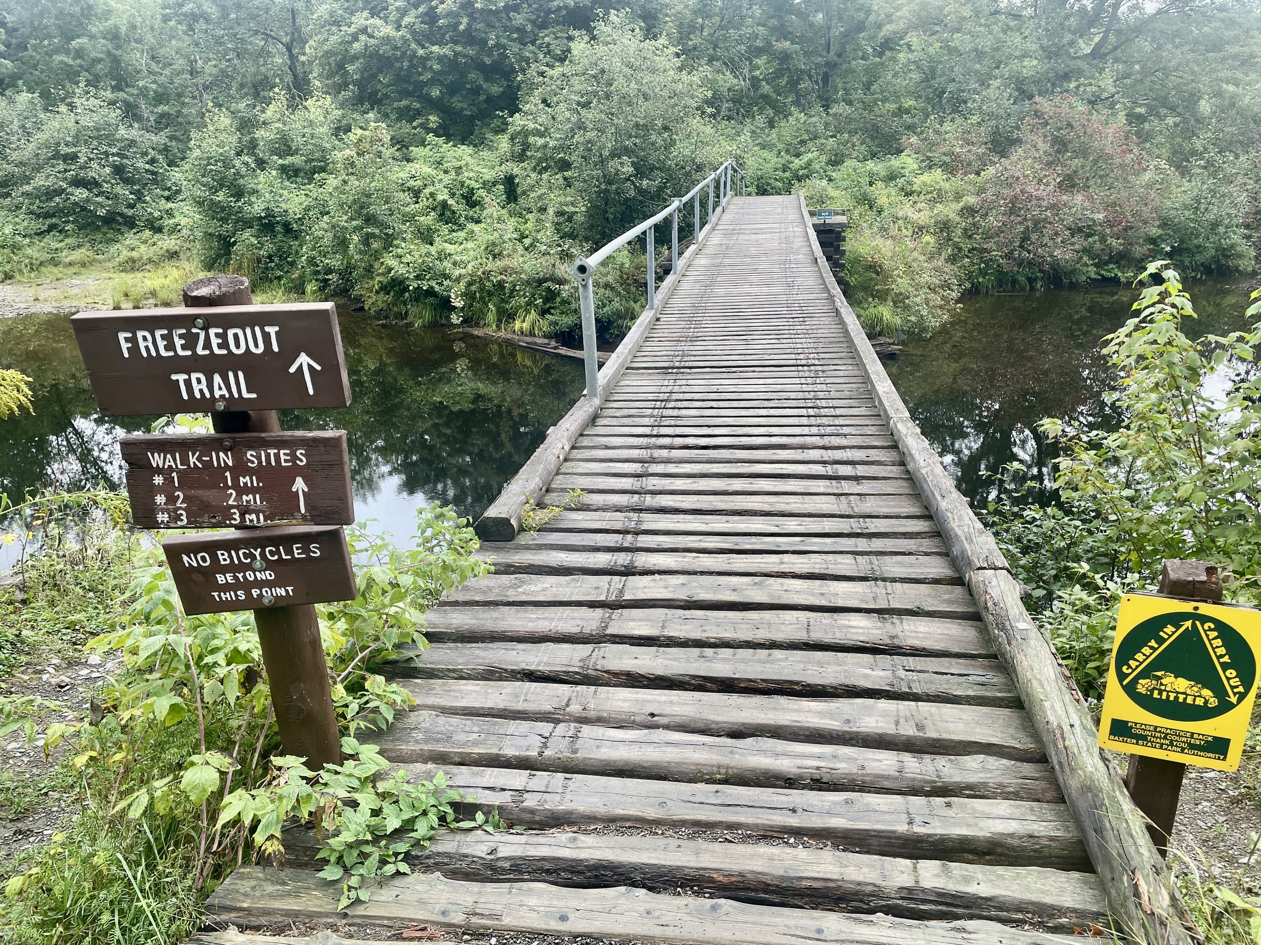
Clouds obscured most summits from view, but the soundtrack of my ride, beyond the rushing air, was that of wide streams rushing through grooved valleys on either side of the road. Occasionally the gusts of wind sounded like traffic about to overtake me, but the road was pretty sparsely populated. And when I made it to Trout Brook, the ranger station was empty. I rolled through to my campsite and didn’t see a soul around. Out across a field, down through a wooded thicket, across a rickety bridge, taking a little side path, and into a clearing.
I was able to set up camp & make dinner just in time before the rain really began. I got into bed just after sunset and listened to the rain fall on the tent. It was laughably warm and dry inside the tent, but anytime I had to leave & return (bathroom break, something I forgot on my bike, it was a careful process of foot-wiping and deft handling of the rainfly vestibule before I could get back in and hunker down.
With the cloud cover and tree canopy, the night was jet black. And the rain seemed to keep the wildlife pretty quiet too. This New Yorker had to listen to a few podcasts before his brain would turn off enough to go to sleep. When I did, I would occasionally wake from the sound of a tree branch snapping or something else, but I was never really all that nervous. My food was hanging in the branches, over 100 yards away, I had bear spray in the tent, and after the long, rainy ride I’d had, I was too tired to waste any extra energy on free-floating anxiety. Besides, bears don’t want to see you any more than you want to see them.
The next morning, the rain was still continuing. And my tent was still warm and dry. And because I had the site reserved for two nights, I weighed the possibility of just staying, horizontal, in my sleeping bag, all day. The two problems with that were that 1) as my wife will attest, I am not someone who does well at doing nothing, and 2) I had no idea what the weather the next day would bring. So I got up & walked to the ranger’s station to get the weather report. Turned out, that day would likely be the better day to ride. So, I hiked back to my site to break camp - which, in the rain, took twice as long as it normally would. But eventually I got out on the road.
Coming out of Baxter through the North end at Matagammon Gate, I rolled past a mountain deli/restaurant/lodge/kinda place. I stopped for coffee and a roll. It was clearly the place where everyone knew each other, and they all looked at me, soggy and muddy and clad in cycling gear, as someone to pity or avoid as they climbed, flannel-clad and collars turned up, into or out of their Tundras or Silverados or Expeditions, caked with mud on the outside but with dry, probably heated seats on the inside.
My goal was to get to Houlton that night, but there are no easy roads straight through. I’d either have to go a long twisty route or ride through a latticework of ATV trails. I had plotted a course through the latter, but I would never do so again on the bike I’m on. Not after already getting a late start. Not during a rainy day (even a light rain, like the one falling then). And not by myself. The golf ball-sized gravel had become fist-sized, and the divots now large enough to hide luggage. And the trails would wind this way and that and my GPS was slow to respond, so sometimes I had to go what I was pretty sure was the wrong way for a bit before the computer picked up the course again and corrected itself.
Suffice it to say that, after a rugged day of riding, getting soaked through to the bone, and racing to make it to my destination before sunset, I was exhausted. (About 7 miles before I got there, I passed a metal salvage or auto body shop with a big sign out front. “He who endures to the end will be saved. Mark 13:13.” I took it as heavenly inspiration.) And I spent the rest of the evening doing laundry, hanging out camping equipment to dry, and taking stock.
The weather reports showed a bad day for riding coming up, so I had an ‘enforced’ rest day in Houlton, today. I took my bike to a self-service car wash to hose off some of the mud & silt. I got some additional AAA batteries. I got a beer to have with my dinner. And I cooked the last of my camp food. And now, here I am, rambling on (and on and on).
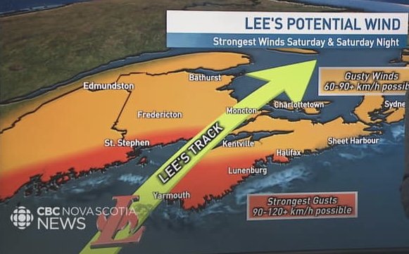
The goal for tomorrow is Presque Isle. As I write this, Hurricane Lee is crawling up the Eastern seabord, headed for coastal Maine. I’ll be well inland, but it’s going to affect the weather for sure; I’m just taking it one day at a time. (And I’m done with camping until I get a night full of stars…)
Lots of wide, slick rock rapids…
… and this was some of the EASIER gravel I had to ride.
The Tolkien-esque woods of Baxter State Park.
Well, it’s not like I rode my bike across the bridge to the campsite.
Time to make my dinner and my bed…
And that was just the first day.
Warm & dry inside!
Finally out of the ATV trails, it was a long, straight county road to Houlton.
Thanks for the pep talk, Mark!
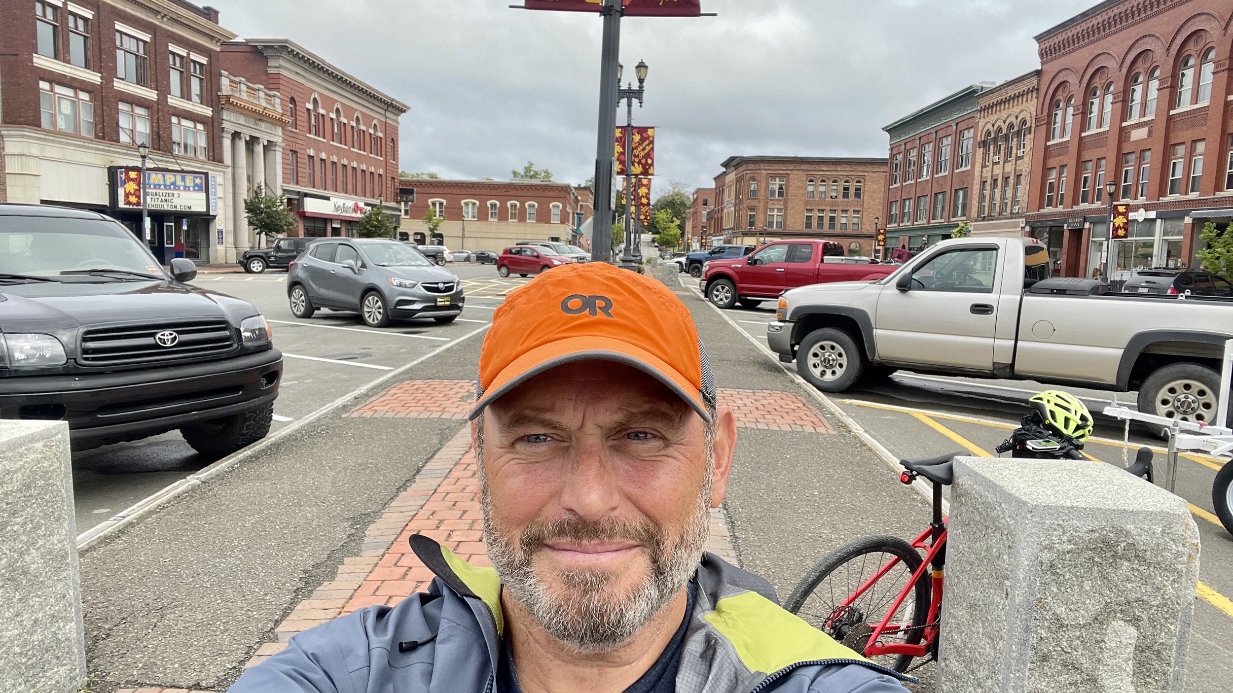
‘Enforced’ day off in downtown Houlton…


